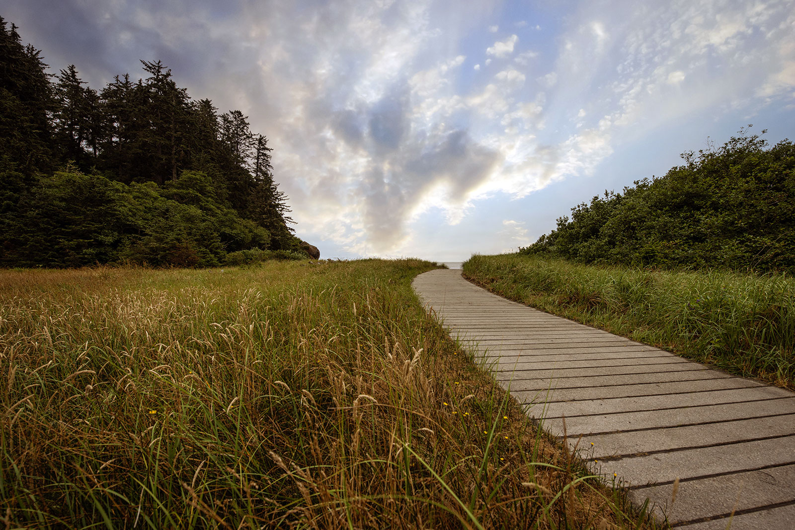
A Confluence of Peregrinations and Prayers
At Cape Disappointment near the mouth of the Columbia River, Maya Lin’s walkway and boardwalk present juxtaposing journeys of discovery.

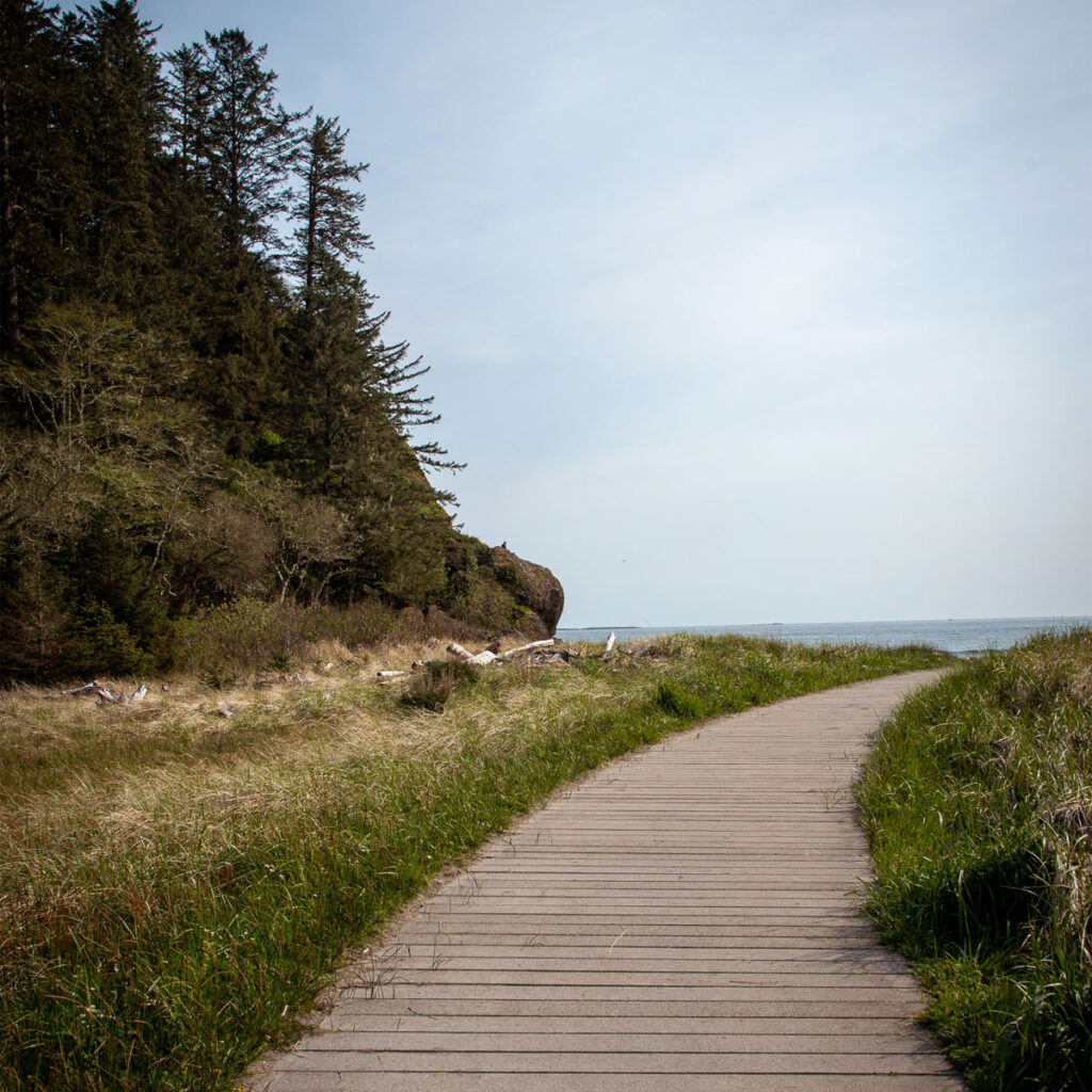
At Cape Disappointment near the mouth of the Columbia River, Maya Lin’s installations present juxtaposing journeys of discovery.
This essay is part of a series on Maya Lin’s Confluence Project, in which I explore the history, heritage, and ecology of five existing sites. You can read more by visiting the Confluence Project series page.
BY LAURA J. COLE | November 6, 2024
Artist Maya Lin intends for her work to be subtle, and this was the hardest of all six Confluence installations to find, but also—possibly because it was the first I visited—the most profound.
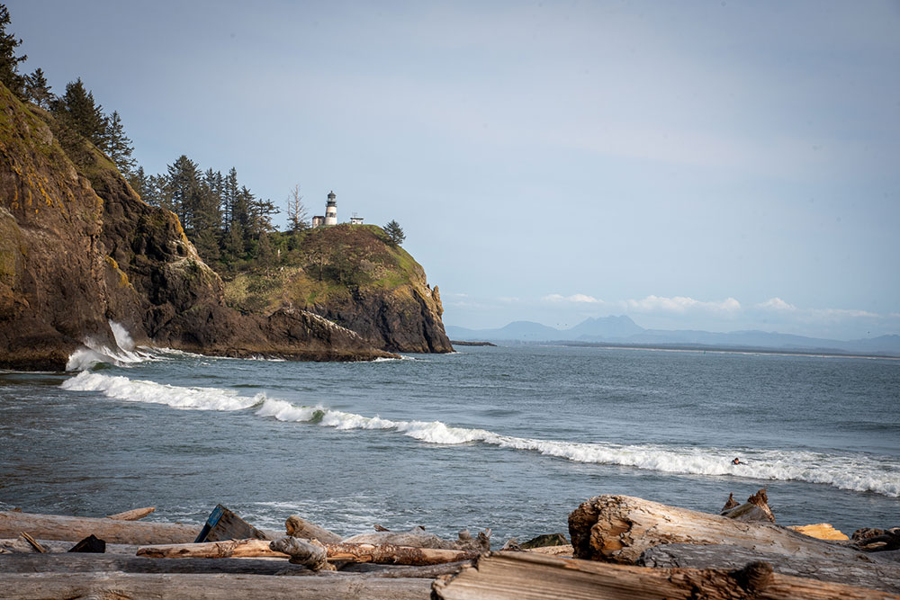
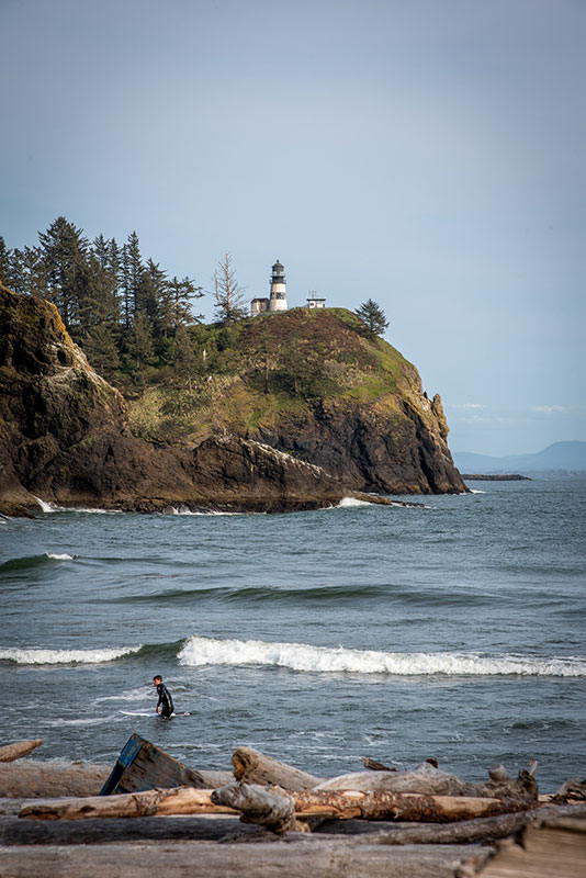
Just beyond the shores of Cape Disappointment State Park, the Columbia River violently merges with the Pacific Ocean. At its confluence is the Columbia River Bar, considered one of the world’s most dangerous navigational hazards. According to author Peter Stark in Astoria, “Here the power of the largest river of the western continent, discharging an average of 265,000 cubic feet of water per second, collides head-on with the power of the world’s largest ocean.” The area, considered part of the Graveyard of the Pacific, is notoriously so difficult to navigate that Columbia River Bar Pilots have been employed since 1846 to ensure the safe crossing of ships, crews, and cargo.
It is at this juncture of turbulent tides that Lin selected to place two installations. One is near Waikiki Beach, named after a Hawaiian sailor whose body washed up on shore after his ship wrecked attempting to cross the treacherous bar in 1811. The other site is on Baker Bay, which has a rich history of salmon fishing. Many fish, including Chinook—also known as King—salmon swim into the calm waters of the bay as part of their journey from the Columbia to the Pacific and back again. For generations, it was an important body of water for the Chinookan peoples to catch, eat, and trade salmon. And by the late 1800s, White settlers had cluttered the shoreline with more than 30 canneries.
Indigenous land of:
Chinook
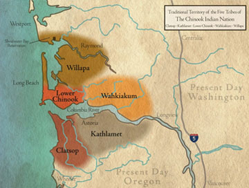
Image courtesy of the Chinook Indian Nation
“It’s symbolically the last walk along the confluence journey.”
—Maya Lin
Unfamiliar with all of this at the time, I started at Waikiki Beach. Upon leaving the parking area, visitors are immediately presented with a choice: Go left, to follow a trail highlighting the Chinookan peoples; or go right to walk along a boardwalk that retraces the journey of Meriwether Lewis and William Clark to find a Northwest Passage to the Pacific Ocean. In the space between lies a wide field of dune grass, sedge, and red fescue.
Drawn to the sound of the lapping waves, I opted to go right first. Beneath my feet were slats of oyster shell concrete with various entries from Lewis’ and Clark’s journals: “Grass houses &tc,” “Across the Great Rocky Mountains,” and “Saw Several Canoes.” Lin spaced out each entry to correlate the distance traveled with the words recorded. Each provides a chance to reflect on the historic journey from St. Louis to its conclusion, here, at this location along the Pacific Ocean.
“It’s symbolically the last walk along the confluence journey,” Maya Lin said of the boardwalk. “As you take that walk, you’re walking through a summary statement of all the places they traveled through along their journey, counting it out mile to mile. What you realize is that you are walking through all these different homelands.”
Shawnee. Osage. Sioux. Nez Perce. Chinook.
Having driven across the country from Florida a few times, I marveled at what it must have been like to do such a journey through wilderness, with no conveniences, plenty of hardship, and vast uncertainty. Yes, Lewis and Clark were hired by President Thomas Jefferson and knew their expedition would entail all of the above. But what spurs people to embark on such a journey? What keeps them going? I feel myself often pulled by a similar curiosity, but am today equally curious about what is the right mix of curiosity, drive, and ethics?
Indigenous land of:
Chinook

The Chinook Indian Nation is made up of the five western-most Chinookan speaking tribes at the mouth of the Columbia River and neighboring seacoast.
Image courtesy of the Chinook Indian Nation
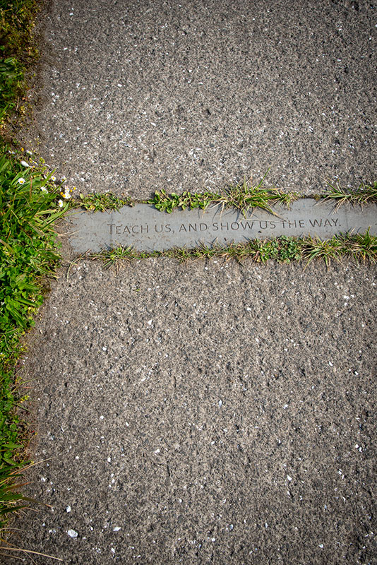
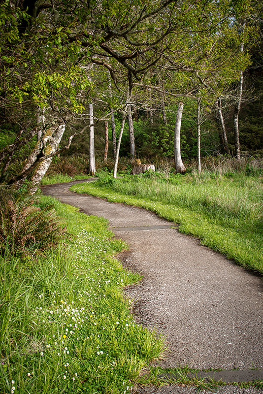
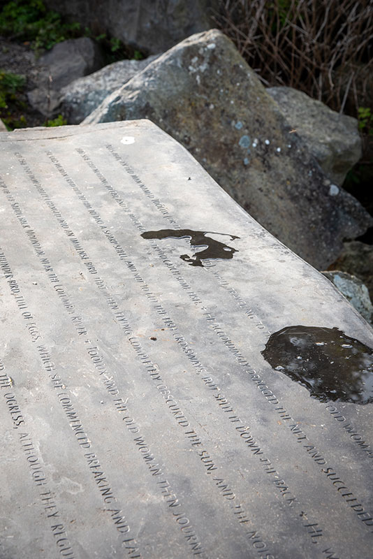
Retracing Lewis and Clarks’ steps back to the source, I considered the cost of adventure and progress, then set forth upon the Confluence trail that winds toward the woods. Along the way, I felt like a child playing a languid game of hopscotch. Instead of numbers, each square has a different verse of a Chinook praise song calling upon the earth, the mountains, the waters, the land, the forests, the animals, the people, and then the Great Spirit: “Teach us and show us the way.” (It is worth reading the entire blessing.) At the end of the prayer, I found myself surrounded by logs of driftwood. At the center stood a cedar trunk that I learned started growing before Lewis and Clark arrived at this spot.
“The path leads to a circle composed of seven found driftwood columns, raised to form a glade where the coastal forest meets the dune grass,” Lin said. “The number represents the seven directions recognized by Native American tradition: north, south, east, west, up, down, and in.”
For many tribes of the Pacific Northwest, including Chinook, western red cedar is considered the “tree of life.” The inner bark was used to make everything from blankets and mats to hats and clothing. They turned the trunks into totem poles, lodges, and canoes. The latter were considered a sacred part of their culture, and each was designed for a specific function: fighting, fishing, transporting goods, and even as ceremonial gifts. The canoes were designed to navigate salt and fresh water, as well as the rough waters of estuary bars. In his journal entry from November 11, 1806, Clark so admired the Chinook’s boatmanship that he wrote: “Those Indians are Certainly the best Canoe navigaters I ever Saw.”
We call upon the earth, our planet home, with its beautiful depths and soaring heights, its vitality and abundance of life, and together we ask that it
Teach us, and show us the way.
—Chinook Prayer
For the Chinook who call this area Kah’eese, it was home. For Lewis and Clark, it was the farthest point west on their journey of discovery. For me, it has become a beacon of both.
I arrived here near the tail-end of my own journey of discovery to many of the national parks across our vast continent. After a divorce, several funerals, and a global pandemic, I often found myself reciting a refrain similar to the one in the Chinook song: What is my purpose? Where am I meant to be?
Teach me, and show me the way.
I became obsessed with the concept of home and what I wanted it to feel like. I knew I wanted to be near this river, this ocean, and that I had a massive gap in understanding the history of this region, the people who called these places home, and what that meant to them. And what it continues to mean.
By the shortest route, my current home is more than 100 miles from Cape Disappointment, my former home in Florida more than 3,000 miles, but I still keep wanting to learn more about myself, our history, and every place in between and beyond. And my frequent prayer is to find a better way—forward, through, and in.
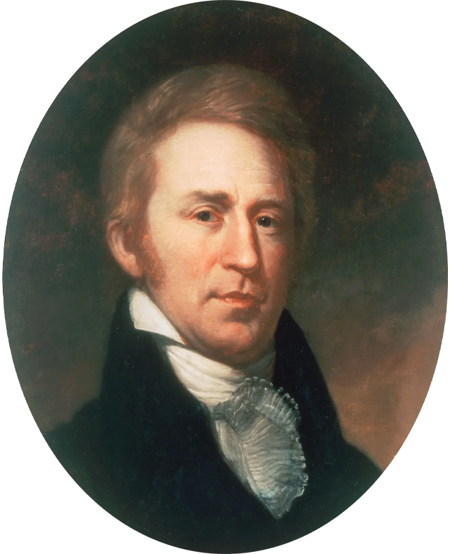
Journal entry
March 30, 1806
“The Waves high & look dismal indeed breaking with great fury on our beech[. A]n Indian canoe pass down to day loaded with Wap-pa-toe roots.”
— William Clark

Did you know?
The Chinook Indian Nation includes the Clatsop and Cathlamet of Oregon and the Lower Chinook, Wahkiakum, and Willapa of Washington. Despite having the oldest existing tribal treaties in the Pacific Northwest, the tribe is still fighting for federal recognition. That recognition could allow the tribes to legally hunt, fish, and gather traditional foods, including their namesake salmon. It would provide them greater protections, the ability to provide subsidized housing, healthcare, and education, and the ability to petition to put land in trust for a reservation.
Image courtesy of Chinook Indian Nation


At Cape Disappointment near the mouth of the Columbia River, Maya Lin’s walkway and boardwalk present juxtaposing journeys of discovery.
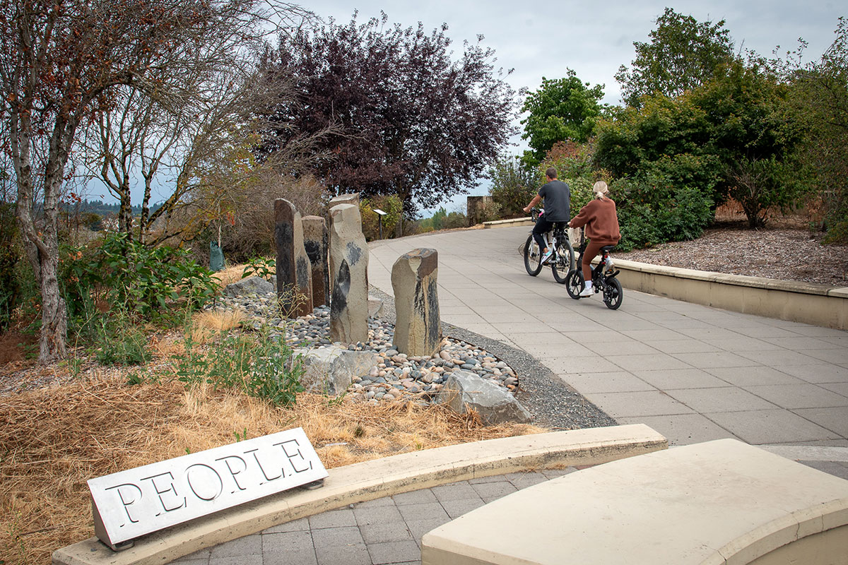
Located near the confluence of the Willamette and Columbia rivers, the Vancouver Land Bridge merges rivers, land, people, and trade.

